How to Track Fish Using GPS and Sonar Technology
Master GPS and sonar to track fish, read structure, and map fishing spots using easy steps and proven techniques for smarter, more successful fishing trips.
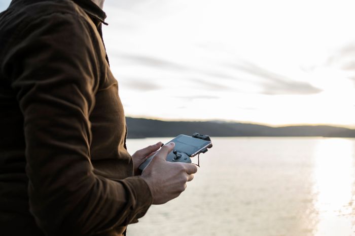
Fishing has moved into a new era where technology shapes how anglers read the water, and many now depend on electronics to find fish with impressive accuracy. In 2025, the blend of GPS and sonar changed recreational and sport fishing by revealing depth changes, underwater cover, travel routes, and active fish zones that once stayed hidden. Beginners use these tools to understand patterns faster, while experienced anglers rely on them to locate fish quickly in shifting conditions. Sonar helps identify what sits below the surface, and GPS mapping organizes waypoints, tracks movements, and builds reliable routes. Together, these technologies create a clear, practical system that helps anglers stay efficient, focused, and consistently connected to productive water.
Understanding Sonar & GPS: How They Work Together
Sonar and GPS function as a connected system, combining underwater visibility with precise surface location. Together, they help anglers interpret depth, structure, fish movement, and the exact placement of productive fishing areas.
What Sonar Does
Sends sound waves that detect fish, bait, depth changes, and structure to create a clear underwater picture.

Displays arches, blobs, vegetation, and bottom hardness, helping anglers understand habitat and fish positioning.
Identifies bottom composition and structure transitions, revealing key zones where fish commonly hold or feed.
What GPS Does
Shows your exact position on the water, ensuring steady navigation and accurate orientation in any conditions.
Creates waypoints to mark productive locations that can be revisited easily on later trips.
Logs movement tracks to retrace successful paths and refine fishing patterns over time.
Maps fishing routes and underwater contours to highlight depth changes and structure lines.
Why GPS and Sonar Combined: The Perfect Fish Tracking System
GPS provides precise surface location, keeping you aligned directly over productive underwater areas.
Sonar reveals real-time underwater detail at that exact point, including fish movement and structure layout.
Used together, they deliver accurate mapping and active detection, creating a dependable fish-tracking system.
Types of Sonar & Fish Finder Technology
Several sonar technologies are commonly used in modern fish finders, and each one supports different fishing techniques by showing underwater detail in its own way. These are the main types anglers rely on today, ranging from broad scanning to detailed imaging and real-time visuals, along with combination units that merge sonar with GPS for stronger accuracy and navigation.
1. 2D Sonar / CHIRP
2D sonar provides the classic view of fish arches, bottom depth, and general structure. CHIRP enhances this by sending multiple frequencies at once, creating cleaner separation between fish, bait, and clutter. It is reliable for scanning broad areas and identifying depth zones quickly.
2. Down Imaging
Down Imaging uses thin, high-frequency beams to show highly detailed structure directly beneath the boat. It reveals vegetation, brush piles, rock edges, and fish tight to cover. This view is especially effective for vertical presentations and pinpointing exact holding areas.
3. Side Imaging
Side Imaging scans wide distances on both sides of the boat, showing logs, ledges, contour breaks, and isolated fish without driving over them. It helps anglers map shorelines, locate new spots efficiently, and understand how fish relate to surrounding terrain.
4. Forward-Facing Sonar
Forward-facing sonar, a major advancement in 2025, displays real-time movement ahead of the boat. Anglers can watch fish reactions, track suspended schools, and adjust presentations instantly. Its precision makes it ideal for open-water and highly mobile patterns.
5. Fish Finder + GPS Combo Units
Most modern systems combine sonar with built-in GPS, allowing anglers to mark waypoints, follow routes, build custom maps, and use sonar readings to maintain perfect positioning. This creates a powerful, all-in-one system for tracking fish and navigating effectively.
Step-by-Step Process: How to Use Sonar to Find Fish
Using sonar effectively starts with understanding how to read underwater information clearly and adjusting settings to match conditions. These steps help anglers identify structure, locate fish, and make confident decisions based on accurate sonar data.
Step 1: Mount and power on the sonar unit: Ensure the transducer is positioned correctly and fully submerged so the system receives clean, uninterrupted signals.
Step 2: Set frequency, range, and sensitivity: Match frequency to depth, adjust range to current water conditions, and fine-tune sensitivity to separate fish from clutter.
Step 3: Select the proper sonar mode: Use 2D for broad scanning, Down Imaging for detailed structure, Side Imaging for wide coverage, or forward-facing sonar for real-time movement.
Step 4: Read and interpret sonar returns: Identify arches, bait clusters, vegetation lines, and bottom hardness changes to understand fish behavior and habitat.
Step 5: Mark productive areas with waypoints: When fish or structure appear consistently, mark the location so it can be revisited accurately later.
Step 6: Verify activity through real-time movement: Adjust speed or lure presentation and watch for a reaction on the screen to confirm fish presence and interest.
Step 7: Save screenshots or sonar logs for review: Recording returns helps compare spots, study patterns, and refine interpretation skills for future trips.
Step-by-Step Process: How to Use GPS to Map Fishing Spots
GPS helps anglers organize locations, track movement, and build accurate maps that make productive areas easy to return to. These steps create a simple, reliable process for marking spots and navigating with confidence.
Step 1: Power on the GPS and confirm satellite lock: Wait for a stable signal so distance, position, and movement are recorded accurately throughout the trip.
Step 2: Load charts and review basic map details: Check contour lines, depth marks, and visible structure to understand the general layout of the water before moving.
Step 3: Create waypoints for key locations: Mark spots where fish appear, where structure is strong, or where conditions look promising to build a clear reference system.
Step 4: Organize waypoints with simple names: Label each point by depth, structure, or date so patterns are easy to track and revisit over time.
Step 5: Use track logging to record movement: Turn on track logs to capture your exact path, making it easy to retrace productive routes or analyze fishing patterns later.
Step 6: Build routes for consistent navigation: Link waypoints into routes that guide you smoothly across the lake or coastline while avoiding hazards or unnecessary detours.
Step 7: Review maps and saved data after the trip: Analyze your path, compare productive zones, and refine your navigation plan for your next visit to the water.
Combined Workflow: Using Sonar and GPS Together to Track Fish
Using sonar and GPS as a unified system creates a complete picture of underwater activity and precise location. This workflow helps anglers find fish efficiently, mark exact positions, and repeat productive patterns across different waters.
Step 1: Study the map and identify likely zones: Use GPS contours, depth changes, and structural features to choose areas where fish commonly hold or travel.
Step 2: Scan the selected area with sonar: Move slowly through the zone and use the appropriate sonar mode to look for fish, bait, vegetation, and structure transitions.
Step 3: Confirm targets by interpreting sonar returns: Watch for arches, bait clouds, and bottom variations to verify fish presence and determine whether the spot is worth investigating further.
Step 4: Mark exact locations with waypoints: When sonar shows consistent activity or strong structure, mark that precise spot on your GPS for easy return.
Step 5: Use track logging to outline productive paths: Record your movement so you can retrace successful lines, understand travel patterns, and refine your search strategy.
Step 6: Position the boat accurately based on both tools: Use GPS to stay over the marked area and sonar to monitor the fish beneath you, adjusting position as needed.
Step 7: Revisit marked areas and compare patterns: Return to saved waypoints to confirm consistency, track seasonal changes, and build a map of reliable, repeatable fishing spots.
Modern Tech Tips for Faster and More Accurate Fish Tracking
Using sonar and GPS efficiently depends on clear settings, steady movement, and awareness of conditions. These practical technology-focused fishing tips help anglers improve detection, navigation, and overall accuracy while locating productive water.
Sensitivity Control: Adjust sensitivity according to water clarity to reduce noise, highlight true targets, and create cleaner sonar images that reveal fish and structure more accurately in varying depths and conditions.
Frequency Selection: Choose high frequencies for shallow detail and low frequencies for deep penetration, ensuring clear readings that help identify fish, structure, and depth transitions across different environments.
Steady Boat Speed: Maintain consistent speed when scanning so sonar returns stay stable, making it easier to identify fish, bait, and structure without distortion caused by sudden boat movement or drift.
Contour Awareness: Use GPS contours to find structure changes, drop-offs, humps, and channels where fish commonly hold, helping narrow search areas and improve efficiency across different fishing conditions.
Environmental Cues: Combine sonar readings with temperature, wind direction, and current flow to understand fish movement patterns, making detection more accurate and improving decisions on where to fish.
System Updates: Keep sonar and GPS software current to improve mapping accuracy, enhance system performance, and access new features that support more precise navigation and fish tracking.
Waypoint Organization: Label and organize waypoints clearly so patterns become easier to identify, helping anglers find similar productive areas and repeat successful locations across future trips.
Targeting Different Species Using GPS and Sonar
Different fish species behave uniquely, and knowing how they relate to depth, structure, and movement helps anglers use sonar and GPS more effectively. Each species responds to specific underwater features, and combining real-time sonar detail with precise GPS mapping makes it easier to locate, follow, and return to productive areas. The table below highlights how these technologies support better decisions for several commonly targeted species.
Species | Depth & Behavior | How Sonar Helps | How GPS Helps |
|---|---|---|---|
Bass | Hold near structure, depth transitions, and vegetation. | Identifies cover, weedlines, bait, and subtle bottom changes. | Maps points, ledges, and contours where bass concentrate. |
Trout | Suspends based on temperature and oxygen levels. | Tracks depth bands and mid-column movement in open water. | Guides trolling routes that follow productive temperature paths. |
Moves along breaks, channels, and deeper contours. | Detects bottom hardness changes and tight-holding groups. | Highlights depth contours and travel paths that walleye frequently use. | |
Striped Bass | Roams in schools chasing bait in open water. | Shows moving bait clouds and tracks suspended fish in real time. | Records trolling lines and marks fast-moving feeding zones. |
Catfish | Relates to bottom transitions, deep holes, and channels. | Reveals hardness differences and identifies deep structure pockets. | Saves nighttime spots and outlines reliable deep-water patterns. |
Common Mistakes When Tracking Fish With Technology
Even with advanced sonar and GPS tools, anglers often make errors that limit accuracy, reduce efficiency, and make it harder to stay connected to target species. Recognizing these mistakes helps improve interpretation, positioning, and overall results on the water.
Incorrect Sensitivity Settings: Setting sensitivity too high creates clutter, while setting it too low hides important targets. Balancing it properly ensures fish, bait, and structure appear clearly without unnecessary noise.
Misreading Sonar Returns: Confusing vegetation, debris, or bait clouds for fish leads to wasted time. Learning the difference between arches, clusters, and bottom transitions improves decision-making and reduces guesswork.
Poor Transducer Placement: A misaligned or partially exposed transducer causes unreliable readings. Keeping it fully submerged and properly angled ensures consistent, accurate sonar performance.
Ignoring Boat Speed: Moving too fast blurs sonar returns, while drifting too slowly skews readings. Maintaining steady movement creates cleaner images and more reliable target interpretation.
Waypoint Overload: Marking too many random points without organization creates confusion. Labeling waypoints by depth, structure, or pattern keeps navigation efficient and meaningful.
Not Updating GPS Maps: Outdated charts reduce contour accuracy and navigation efficiency. Regular updates ensure access to the latest depth information and improved mapping features.
Skipping Track Logging: Failing to record your path makes it harder to retrace productive routes. Track logs reveal patterns and help repeat successful fishing paths across future trips.
Conclusion
Understanding how sonar and GPS work together creates a clearer, more efficient approach to locating fish and navigating the water. These tools transform the fishing experience by revealing structure, depth changes, and real-time activity while helping anglers stay positioned on productive spots with accuracy. The combination of underwater detail from sonar and precise mapping from GPS makes it easier to recognize patterns, follow movement, and return to proven areas across different seasons. Applying these techniques consistently improves confidence, decision-making, and overall success on the water. Explore the fish-species directory on Guidesly, book a local guide for hands-on learning, and apply these techniques on your next trip to sharpen your skills and improve your success.
FAQs
How accurate are modern fish finders when locating fish?
Modern fish finders offer strong accuracy by using advanced signals to separate targets from noise, especially when settings, boat speed, and water conditions are properly balanced.Can GPS help anglers avoid underwater hazards while fishing?
GPS maps display hazards, shallow areas, and marked obstacles, helping anglers navigate safely, avoid damage, and maintain confident travel through unfamiliar or structure-heavy waterways.Do fish finders work in muddy or stained water?
Fish finders work in stained water, though clarity decreases. Adjusting sensitivity, lowering frequencies, and scanning slowly helps maintain readable results in low-visibility conditions.How deep can sonar technology detect fish reliably?
Sonar systems detect fish at various depths based on frequency strength, transducer power, and water clarity, allowing consistent performance from shallow areas to deep-water environments.Can fishing kayaks use GPS and sonar systems effectively?
Compact GPS and sonar units designed for kayaks provide dependable depth reading, structure visibility, and waypoint marking without requiring heavy equipment or complicated installation setups.Does the weather affect GPS accuracy while fishing?
Weather rarely affects GPS, but dense cloud cover or storms may slightly reduce signal strength. Modern systems maintain stable accuracy through improved satellite connectivity.Can sonar detect fish close to the surface?
Sonar struggles near the surface due to weak returns. Adjusting angle, depth range, and sensitivity helps improve the detection of fish positioned high in the water column.Do fish finders require frequent calibration?
Fish finders seldom need calibration, but occasional adjustments to depth offsets, filters, and transducer alignment ensure consistently accurate and reliable readings during regular use.Is it possible to use fish finders in saltwater and freshwater?
Fish finders work in both environments, though saltwater usually requires stronger frequencies and deeper scanning capabilities to maintain clear, dependable target separation.Can GPS store multiple fishing trips and routes?
Most GPS units save extensive routes, tracks, and waypoints, allowing anglers to organize past trips, study patterns, and revisit productive locations with consistent accuracy.